Bukit Saga hike to peak with mini outdoor gym

It was a cool Friday morning yesterday. I was super excited because I would be following my friends to hike up Bukit Saga in Ampang for the very first time. Wow! Just the thought of the new hiking excitement really pumped me up. I couldn't wait.
I followed my friend's instruction drive from my home to the foothill of Bukit Saga, Ampang using Waze. The landmark would be the white apartment Pangsapuri Bukit Saga located at foothill of Bukit Saga hiking trail entrance.
It was rather easy to find foothill of Bukit Saga with Waze. The white apartment Pangsapuri Bukit Saga could be easily seen from afar once I drove towards Bukit Saga. The sights of hikers along the road side an parked cars were also clear signs that I'd found the right place without getting lost.
I arrived at Bukit Saga at around 7.00 am, fifteen minutes earlier then our meeting time. The first dawn of light was about to rise. I was fortunate that I managed to witness the breathtaking "night view" of towering magnificent buildings of Kuala Lumpur laid out beneath my feet from the top of Jalan Taman Saga. The view was truly spectacular!!
Bukit Saga hiking trail entrance
The sign up to Bukit Saga was very clear. It was just right at the junction before turning right to the white apartment Pangsapuri Bukit Saga.
I was told that there were two routes to choose from:
- Route A (on the left): more challenging with steeper route with steps made from the soil held in place by pieces of wood salvaged from construction sites. Some of the more vulnerable sections were reinforced with cement.
- Route B (on the right): not as steep but longer distance.
With GoPro HERO Black action camera in one hand and a small little backpack with a towel and isotonic drink on my back, off we hiked up Route A at the dawn of light. We greeted cheerfully the regular hikers who reside around the area as we walked past them.
 |
| Main hiking entrance to Bukit Saga - a very clear sign. |
Uphill ascending Bukit Saga hike
Before I went to Bukit Saga, I had an impression of a trail road filled with muddy soil and narrow roads. Perhaps some bushes along the trail as well.
I don't own a pair of hiking shoe. So I wore Saucony Kinvara running shoe for the hike. I was hoping my running shoe could hold me up well as I didn't want to slip for my first hike. lol!
Surprise! Surprise! Surprise! I was so surprised to see that Bukit Saga hiking trail was so spot clean and well-maintained! No trash. No rubbish.
The trail fully utilized tree roots and rocks as stepping ground for the hike. What impressed me most was the fact that there was no muddy soil but only well-made steps on the steep trail all the way up to the peak. The steps were made from the soil held in place by pieces of wood salvaged from construction sites. There were quite a number of round steps too. After taking a closer look, only then I realized the round steps were made of cement in the shape of paint containers. Some vulnerable sections were even reinforced with cement.
 |
| made from the soil held in place by pieces of wood salvaged from construction sites |
 |
| Steps made with such details... could only be done by the hikers themselves! |
I could tell the step makers made these awesome trail steps with their heart and soul. I could tell the step makers were not from the government body. I could tell the step makers were hikers themselves. Every single step and every single turn; even the height, gap and width of the steps were made for easy hiking despite the steepness. They must have hiked up themselves and they tried to make it easier for others.
That was exactly the feeling I felt when I ran a full marathon with the race route planned by race organizers who themselves are runners as well. Truly awesome!! I really salute to the step makers (whom I later found out to be from Persatuan Pendaki Bukit Ampang, Selangor)!! Bravo!
 |
| Very steep steps - with total elevation of 409 meter |
We bumped into a few aunties who were regular hikers. One of them, I believe in her sixties, blasted her music really loud like a teenager. She was hiking up herself despite her knee pain. Such strong, positive spirit permeated out from her!! Cool!
The whole trail was covered by trees and woods which made it rather cooling. I couldn't help myself to notice some really tall trees with big tree trunks!!
And the air in the woods was so fresh!
 |
| Love the trees in the hills |
 |
| Yay!! Back to the nature.. it will be so nice to be surrounded by nature everyday! |
The Bukit Saga peak with mini outdoor gym
 |
| Persatuan Pendaki Bukit Ampang Selangor sign! I pay salute and respect to the association for keeping Bukit Saga so clean and nice fully equipped with so many facilities with hikers in mind. |
We reached the peak / summit after a slow and easy forty five (45) minute hike. The distance was about 1.5 km. According to my Garmin VivoActive GPS watch, maximum elevation was 409 meter. Oh wow! We were at the peak!!
I was up for another big big surprise when reaching the summit!
Before I came, I had the impression of a peak that might allow me to see the views of Kuala Lumpur. Perhaps it would be nothing at the peak, the most a small little hut for the hikers.
Boy! Was I totally wrong! I was pretty cool that I couldn't see the view of Kuala Lumpur from the summit as expected. We were in the thick woods and trees. Anyway, I had a wonderful glimpse of the whole Kuala Lumpur at Jalan Taman Saga near Bukit Saga foothill earlier.
Never in a million years I would have thought to see an outdoor mini gym, playground and many other wonderful facilities at the big compound at the summit.
Here were some of the marvelous facilities made by Persatuan Pendaki Bukit Ampang Selangor for the ease and convenience of other hikers:
- hammocks
- large tent shelter
- camp tables
- benches for trekkers to relax and rest
- cement dumbbell
- Hanging bar to do hanging leg raises or shoulder exercises
- Declined bench for doing leg raises or situps
- Long thick wood for doing shoulder press
- pebble stone walking track for foot massage and blood circuations
- clean toilet with clean water
- swinging chairs for children below twelve (12)
This peak provided the hikers with a mini outdoor gym for their core strength training and a place to rest and play. It wasn't all leg training during the hike. A rather complete full body workout I might say!
 |
| large tent shelter with morning hikers in sight |
 |
| Big ground with many wonderful faciities |
 |
| Big ground with many wonderful faciities |
 |
| swinging chairs at the peak! Wow! |
 |
| Look at this uncle - in his either late 50s or early 60s - doing the split!! I couldn't even do that!! Such agile flexible legs!! |
 |
| A hiker doing sit ups on the declined bench |
 |
| This trail doesn't only provide leg and cardio exercises. Hikers can also do strength training at the peak. |
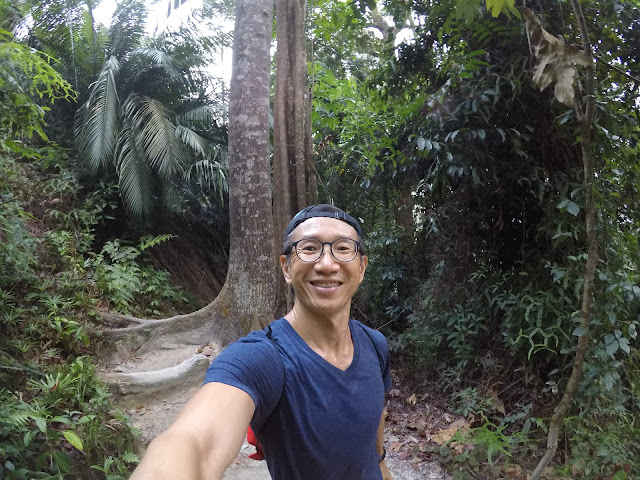
 |
| Yes! Yes! Yes! A selfie with GoPro BLACK action camera |
 |
| How could I resist not to lay down on the hammock? |
Downhill descending Bukit Saga hike
After spending about 30 minutes at the summit, we decided to descend using the route A2, leading back to route A where we hiked up earlier.I must say I wasn't a fan of hiking down the hill, especially with the steep slope! I found the landing and pounding was rather bad for my knees. Perhaps I didn't learn the hiking technique yet. And I was not wearing the proper hiking shoe anyway. My Saucony Kinvara running shoe didn't hold me up too well. A couple times, I stepped on some sandy patches. I almost skidded. Anyway, it was a great hiking experience for me before I decide whether I would buy myself a new pair of hiking shoe one day!
I stayed as the last person on the way up and down because I didn't know the trail route. It was also easy for me to stop and take photos of the natural wonder whenever something caught my eyes.
 |
| steep steps, aided by ropes and walking sticks (for some). |
 |
| Look at the huge trees!! I hope 30 years later the trees are still around! |
 |
| Ok - you all go down first! Let me take a photo of my shoes and the hiking trail! haha! |
 |
| Some of the steps were to step on the natural rocks and stones |
 |
| Exploring my GoPro HERO Black action camera's feature: time-lapsed photos. I love the output! |
Back to foothill of Bukit Saga
 |
| Back to the nature at Bukit Saga covered with greenery |
According to my Garmin VivoActive GPS watch, we spent about two (2) hours this morning. On average, we spent 45 minutes up and down each way and another 30 minutes at the peak / summit relaxing, exercising, stretching, taking photos. :)
With elevation of 409 meter, it was rather a nice challenging hike for me as first timer! Look at the Google Maps shown on GPS watch of Bukit Saga: hiking into the hill covered with trees.
It was truly a back to nature morning with lots of fresh air and thigh training!!
Bukit Saga - you surely have a place in my heart for your cleanliness, well-maintained hiking trek and a complete mini outdoor gym at the peak. I shall come back to explore Route B as well as the waterfall next.
The saga of Bukit Saga to be continued... :)
 |
| Happy happy for completing my first hike in a long time! |
 |
| Started this article with a view before sunrise. Now ending this article with the same view after sunrise. |
Written by Vincent Khor on July 29, 2017.